Sensing Regulated Rivers: Ecological Connectivity For Riverine Wildlife
First published in Sanctuary Asia,
Vol. 46
No. 10,
October 2026
By Nachiket Kelkar
Researchers at the Wildlife Conservation Trust, in partnership with The Habitats Trust, have been developing and implementing novel approaches to monitor and design mechanisms that could provide ecologically suitable flows in India’s dam-regulated rivers. These interventions could help improve functional connectivity for wildlife habitats, river ecosystem conservation, and sustainability of dependent livelihoods.
Our rivers are deeply affected: their flows regulated by dams, their waters fouled by pollutants and plastic waste, and their wildlife and people left facing an uncertain future. In some rivers, stagnation and degradation are now so severe that one could, sadly, step into the same river twice, something that can never happen in a flowing, thriving river.
Given the scale of these pressures, how does one really understand the pain of a broken, ill river? Like a physician, can one feel the rhythm of its beating pulse and diagnose the illness? Or like a shrink, make the river rest on a couch and speak its heart? For hydro-ecologists, it is both, and much more, through their comprehensive, integrated, and multi-disciplinary practice of river science.
Today's river science tries to understand how connectivity has been broken by dams, barrages, and other structures, and what can realistically be done to restore it. This means looking beyond simply maintaining flow from upstream to downstream (longitudinal connectivity), at restoring a river's lateral connections to its banks and floodplain vegetation, its vertical connections with groundwater recharge, its exchange of moisture with the atmosphere, and finally, sustaining all of these over time.
The first step is to understand the water balance of a river catchment. Rain and snow enter the system, and the water is then divided among rivers, wetlands, ponds, groundwater, plants, and the atmosphere. Some is stored in the soil, some recharges groundwater, and some returns to the atmosphere through evaporation and plant transpiration, together known as evapotranspiration. Rain gauges, river gauges, groundwater sensors, and soil probes let us measure or estimate these flows, and the balance shifts with the seasons. Monsoon rain and floods make surface water and groundwater recharge dominant, while in the hot, dry months, evapotranspiration and water use by crops and forests make the biggest demands on the system. Once we understand this shifting balance, we can examine how dams, reservoirs, and other diversions alter the timing and amount of water moving through the catchment.
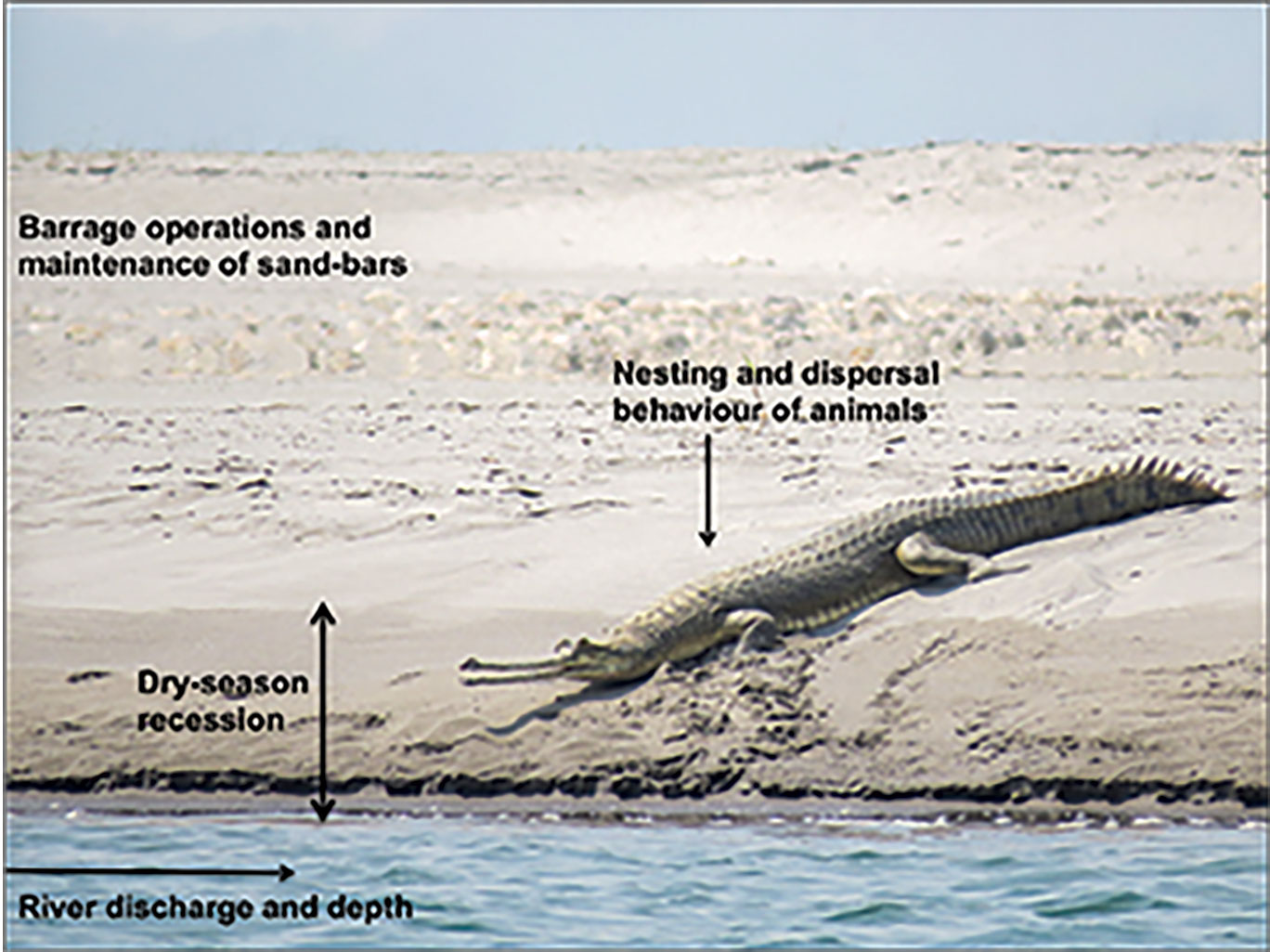
A robust ecological flow assessment must link river flow, depth, width and water levels with barrage operations and species’ nesting and dispersal behaviour. Photo: Tarun Nair.
Impacts Of Altered Flows
Dams and other impoundments alter the natural variability of river flows in two ways: by dewatering rivers, reducing water flows to far below natural dry-season levels, or by adding water unpredictably through sudden, unseasonal releases that artificially swell a river when it would naturally be running low.
Both impacts have critical implications for riverine wildlife. Dewatering affects species dependent on in-stream aquatic habitats, such as river dolphins, causing them to get stranded or entrapped in shallow areas.
Unseasonal releases could lead to erosion of species’ nesting sites on river islands and banks. With this, crocodilians, turtles, and birds, can face total breeding failures. In the Gangetic plains, highly endangered species such as the gharial, several riverine turtles, and birds such as the Indian Skimmer, continue to fall victim to such sudden washouts in May or June, just as their eggs are ready to hatch.
Unseasonal releases also cost otters and turtles the river-island habitats they use for basking, foraging and socialising. More broadly, dams disrupt entire food webs, encourage invasive species, and alter sediment flows and carbon retention across rivers, compounding the threats these species already face from hunting, sand mining, pollution and fisheries bycatch.
These impacts trace back to human water demand, met through irrigation canals and power channels that divert water from dam storage. As the demand increases, less water reaches the river downstream. Yet the governance of that demand, by settlements dependent on canal irrigation, and by urban areas and industries dependent on power, has real gaps. These lie in the timing and efficiency at source and destination, in realistic estimations of actual need, and in cropping shifts towards thirstier crops such as sugarcane, which are then deployed to justify further irrigation projects. These gaps lead to serious over-irrigation and water wastage. In the Gangetic plains, the resulting excess land-surface moisture is now recognised as one of the factors weakening monsoon rainfall over the region. Such wastage represents a net loss of water that would otherwise have reached the river.
These gaps also point to an opportunity: that of re-operating existing dams more ecologically to restore functional connectivity downstream. Prescriptions for so-called minimum flows, or ‘e-flows’ (environmental flows), have evolved over time. Yet the outdated idea of ‘minimum flows’ still shapes how dams are managed in India. Calculated ad hoc as five or 10 per cent of the river’s natural dry-season flow, many dams and barrages allow only a minimal release sometime between March and May. There is no guarantee that even this much will reach the river during periods of drought or lowest flow.
Environmental flows do somewhat better, with seasonal adjustments that reflect a river’s natural variability, though these releases are often designed to flush sediment or recharge groundwater rather than serve wildlife or ecology directly. Where irrigation diverts much of the flood-season flow, environmental flow planning may also include ‘artificial floods’. However, even these do not fully address the needs of threatened species, fisheries, habitats, and riverine and riparian connectivity that sustain their lifecycles. 'Ecologically adequate flow regimes' go further, allowing nuanced, species-specific, and adaptive allocations that try to balance human demand with the river’s seasonal needs, mimicking flow variability as closely as possible.
Water is contested within the human world, between states, districts and sectors, over how much is needed, when, and whether it is available at all. These political-economic realities shape river flows as much as engineering decisions do. Dams themselves pose structural problems.
Few dams or barrages in India are engineered with under-sluices that allow sediment to pass through. Accumulated sediment is therefore a severe problem not only for the downstream river deprived of it, but also for the engineering life of the dam itself.
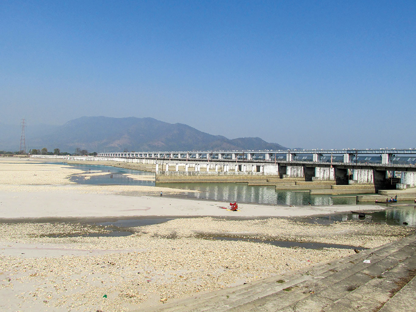
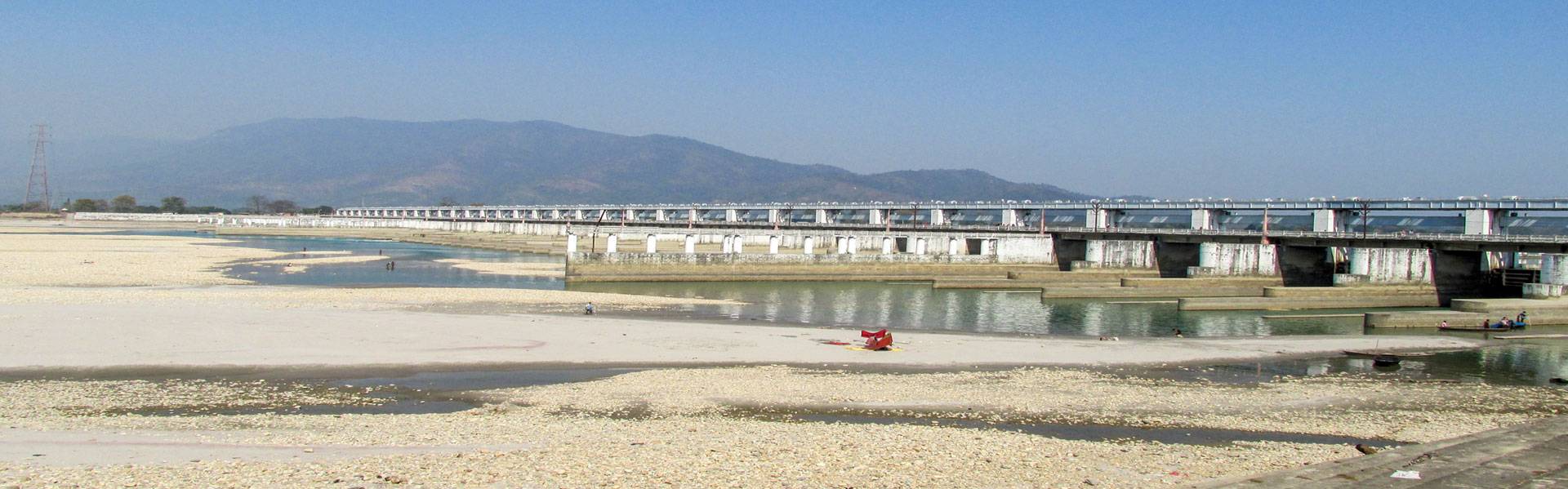
The Gandak river downstream of Triveni barrage showing flow releases that can affect nesting gharials and freshwater turtles if unseasonal. Photo: Nachiket Kelkar.
Continuous Monitoring
One basic element often remains missing: continuous, near real-time data on river water levels and flow volumes downstream of dams. Dry-season water level and discharge data have long been hard to access, often 'classified' and seldom released to independent researchers or citizens. This is slowly changing as digital communications make data easier to share. But accessing past data to understand trends remains hard. This makes it difficult to answer even elementary questions: how much water is available now, how much is required ecologically, and where could it come from?
Our team at the Wildlife Conservation Trust has been working to address these questions across the Gangetic plains and central India, with hydrological data collected in the field at the core of our analysis. This matters because it is now easy to model an entire river's flow from a desk computer, using equations built only from secondary or remotely sensed data.
However, modelled estimates miss more than they reveal. They reduce the river to volumes of water or sediment, its species to variables in an equation, and its riverscape to a predictable system governed by fixed rules. Such models continue to be complex, and their insights at continental scales are useful, as seen in many emerging publications. However, on the ground, at the small-scale, they fall short and do not align with reality, remaining useful as mere heuristics than indicative of real-world solutions. As the ecologist Daniel Botkin wrote in Discordant Harmonies, “When we make nature act like a machine in a computer programme, … the results are quite unnatural...”
Our aim is to build a solid, field-derived body of knowledge and practice on ecological flow management for regulated rivers. Support from The Habitats Trust has helped us scale this work, on both the technology and data integration fronts, across the Gangetic plains. We are now collating and integrating diverse hydrological and sediment datasets across riverscapes, drawn from depth cross-sections from rivers on small boats, of mapping of river course changes, sediment deposition/erosion, and meandering patterns from satellite images, to manually recording river reference station-level gauge data, and using analytical computer models. The objective of this effort is to find ‘genaralised’ rules from robust flow measurements and estimates and barrage regulators make ecologically oriented, optimal, and adaptive decisions on how dams may release water.
We have also installed sensors: acoustic and capacitance-based water-level recorders, rain gauges, and manual staff gauges. The latest are RADAR-based and ceramic sensors measuring water level and temperature on the Gandak river, with a microcontroller that can transmit data to our teams anywhere in India, with more sensors ready for deployment on other rivers. For over a decade, our team has compiled large datasets on flood- and dry-season river levels, irrigation diversions, and dam releases, drawn from public records with painstaking manual entry. We are now building web-based dashboards to host this data, with interfaces that let multiple users explore patterns and assess the scope for e-flows themselves.
The larger idea is to use continuous data to detect even short-term but significant changes, analyse them through machine-learning and statistical algorithms, and generate early warnings when species may face critical risks. These warnings can then be shared with dam authorities to regulate flows and minimise ecological risks to riverine species. For instance, a sudden dry-season release from a dam or barrage could trigger an alarm, to help prevent downstream water levels from approaching critical inundation thresholds at a nesting site.
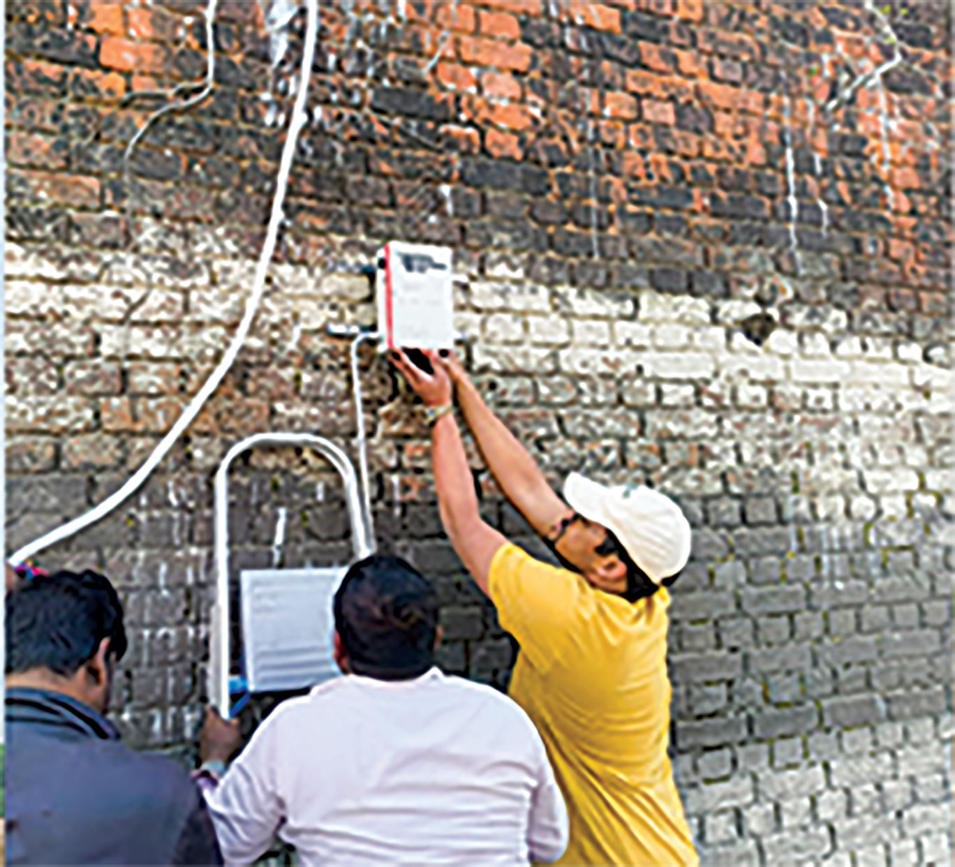
A suite of sensors has helped us track river water levels and temperature across multiple rivers, enabling long-term, real-time flow monitoring. Photo: Nilesh Singh.
Learnings
In 2015-16, downstream of Bansagar dam in the Son Gharial Sanctuary, scientists from the Ashoka Trust for Research in Ecology and the Environment (ATREE) and Foundation for Ecological Security (FES), working with the Madhya Pradesh Forest Department, set up a communication system with dam authorities to manage graduated release flows in May-June, successfully protecting gharial nesting banks without compromising electricity generation from the dam's power channel. This experiment offered a realistic way to manage ecological flows in regulated, water-starved rivers such as the Son. Later, on the Gandak, through a multi-institutional, collaborative Indo-UK project supported by the Ministry of Earth Sciences, India, we established the importance of groundwater-fed base-flows to the river during the dry season. Deficits in canal irrigation, on account of high siltation and inefficient water transfers for end-user farmers, led to more water becoming available to the river, from both regular barrage operations for ‘sediment flushing’ and return flows from canals. Since then, we have carried out similar assessments on the Ganga, Kosi, Chambal, Beas, Pench, and Cauvery.
Communication And Collaboration
Field-based research and monitoring is easier said than done. Ultimately, the action depends on actors and institutions often invisible to the best of computer models: local communities, water governance, cropping subsidies, systemic inefficiencies, corruption, and everyday decisions by officials and farmers. But at the core of it lies something no scientific data or models can do without: open communication and collaboration. Timely warning systems between dam authorities at the point of release, and ecologists, and forest staff at the point of reception could address much of what it takes. Within India's centralised water management paradigm, shared knowledge between state departments, ecologists and civil society is critical to find solutions.
Hopefully, such exchanges will save creches of gharial hatchlings in May on the Chambal, protect river islands carrying skimmer egg clutches in mid-June on the Son, keep dolphins from stranding in the Gandak's shallow side-channels, and help otters on the Cauvery find fish for their pups.
This article represents the collective work of Jagdish Krishnaswamy, Tarun Nair, Vedant Barje, Subhasis Dey, Sunil Kumar Choudhary, and many more colleagues. We appreciate the support of the State Forest and Water Resource Departments of Bihar, Madhya Pradesh, Maharashtra, and Rajasthan. We acknowledge The Habitats Trust, BNP Paribas India, KCT Group Trust, Vinati Organic Ltd., Connected Conservation Foundation, and Wildlife Conservation Trust for funding and institutional support.
Nachiket Kelkar heads the Riverine Ecosystems and Livelihoods programme at Wildlife Conservation Trust, India, which focuses on riverine wildlife conservation in the Indo-Gangetic plains. He studies linkages between species biology, river-floodplain ecology, hydro-climatic trends, and social change. He is an Assistant Professor, Trans-Disciplinary University; and Adjunct Scientist, Foundation for Ecological Research, Advocacy and Learning (FERAL), Bengaluru.