Panoramas, Peaks and Snow
First published in Sanctuary Asia,
Vol. 40
No. 6,
June 2020
By Ranjana Pal
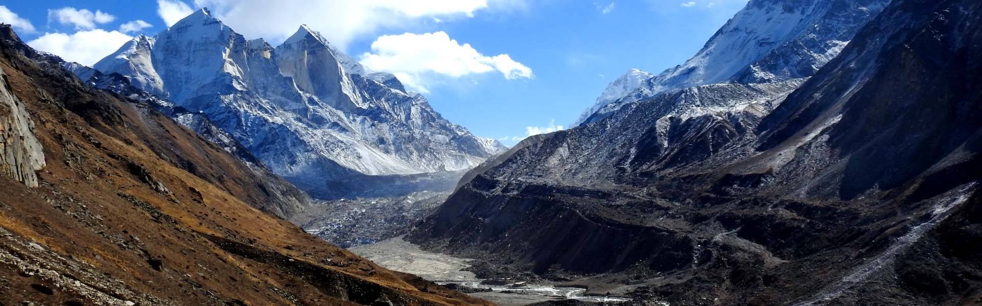
Seated at an elevation of 4,000 m. in the grassy meadow near Bhojbasa, I had a panoramic view of the Gangotri glacier, with a group of Bhagirathi crests on one side, and the towering Shivling peak on the other. In the center reclined the unending wave of a glacier. I was looking at the heart of the landscape where the massive Gangotri glacier pumped out water and the mighty Bhagirathi river was born.
That morning of May 2018, the sun rose, as it did every day, from behind the peaks, slowly warming the valley. I noticed a chain of trekkers slowly marching towards the Gaumukh glacier. They would cross Kalindi pass (6,000 m.) in the next four to five days, a challenging and adventurous trek. Suddenly, my attention was drawn to a huge mudflat they were approaching. Visitors to the glacier before July 2017 would remember a completely different picture than what Gaumukh presented now. An outburst in the adjacent Raktvan tributary had led to a massive landslide and a mass of debris now covered the glacier snout. The view is not only disappointing, but also worrying. Snowfall is gradually declining in the area. The famous Gangotri glacier is believed to have receded up to three kilometres in the last two centuries, and such outbursts only accentuate the process. I began to wonder about the millions of people living along the banks of Ganga, most of them with little awareness that their drinking water relies on sources like the Gangotri glacier and that in the coming years, water shortages will be the norm.
My chain of thought was broken by a whistling alarm call from a blue sheep herd grazing at a distance, reminding me of my visit’s purpose. Immediately, my gaze shifted towards the cliffs, where the ghost of the mountains, the snow leopard, might be stalking its prey.
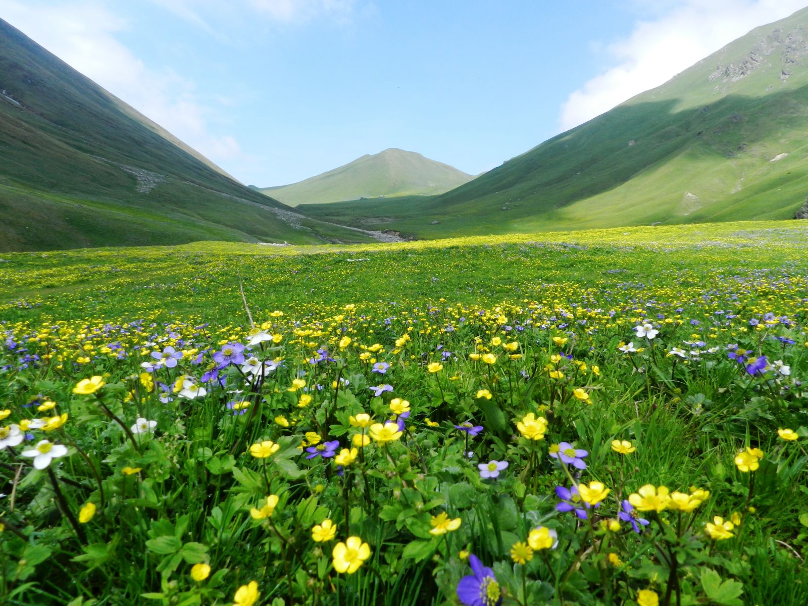
The flowery meadows of Gidara, Uttarkashi, in full bloom. The greater Himalayan valleys, Kedar valley, Gangotri and Rudragaira, says the author, have the best of grassy meadows that offer picturesque views of vibrant flowers in the summer. Photo by: Ranjana Pal.
The National Mission
I was here as part of a much wider mission. The exploration of the Bhagirathi catchment began in 2015 as a part of a larger goal; to understand the changing climatic scenarios in the Indian Himalayan landscape. Launched in 2014, the National Mission for Sustaining the Himalayan Ecosystem (NMSHE) aims to build and support capacities to assess climate change and to formulate adequate response measures in the Himalayan region. Six different task forces from the country’s premier institutions have been identified. The Wildlife Institute of India’s (WII) responsibility is to study the effects of climate change on micro flora and fauna populations; the Bhagirathi basin in Uttarakhand is one of the study sites.
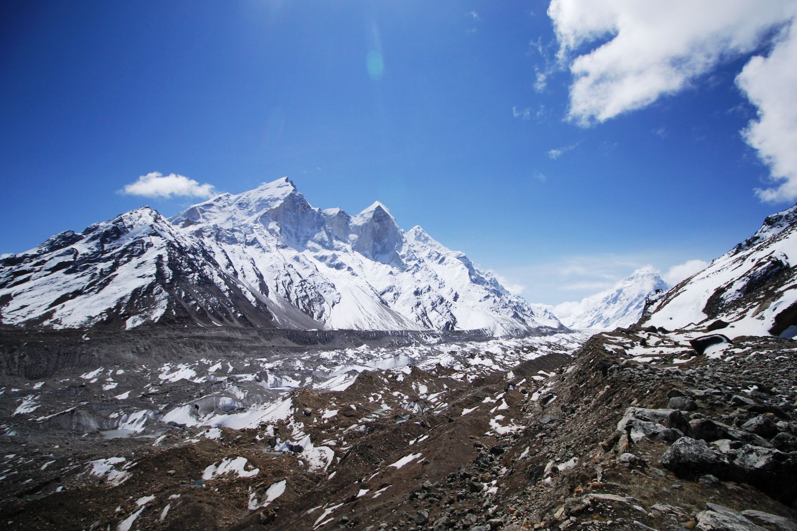
The Gangotri glacier, the source of the Bhagirathi river, is believed to have receded up to three kilometres in the last two centuries! Mountain glaciers feed rivers and the thinning and receding of glaciers will mean less freshwater for millions of people. Photo by: Natik Patel.
Drawn to the Upper Limits of Life
I was back in the Bhagirathi basin for my next trek. On the morning of July 10, 2019, at around 5 a.m., while prepping for the trek, I checked my rucksack for the third time, trying to reduce the weight; instead, I added an extra pair of clothes. It was around mid-July and the monsoon had almost reached Uttarkashi. Clouds and mist had replaced the sun and if one does not want to sleep in drenched clothes, an extra pair of clothing is indispensable. My team of porters and assistants was still asleep. I woke them up and in about 40 minutes we started off from Maneri, a small town near Uttarkashi, toward Dharali. After breakfast at a small hotel, we bid goodbye to our driver asking him to meet us near Jangla Bridge after seven days. With one look up at the ridge line, which stood high at the base of the Srikant peak, and a deep breath, we began taking slow steps uphill. This had been my routine for the past four years, following the different tributaries up to their origins and tracing the mountains for mammals.
My curiosity to understand how species use this rugged and diverse mountainscape is what motivated me to climb these peaks season after season. Under the supervision of Dr. S. Sathyakumar, an experienced mountain ecologist and scientist at the Wildlife Institute of India, I planned my doctoral research on mammal species of the Upper Bhagirathi Basin. My focus was to understand animal response to changing environmental conditions. Toward this, I began generating seasonal information on the distribution and abundance of mammals with the help of a modern-day technical wonder – the sneaky but savvy camera traps, placed in every nine square kilometre area. We’d move our campsites every day in search of a location to deploy two or three cameras. Even after arriving at our base camp in Maneri, Uttarkashi, and barely resting for three to four days, we set out for expeditions every winter and summer without fail, between 2015 and 2018. During this period, we were successful in distributing camera traps in 200 locations across different valleys in the Bhagirathi basin.
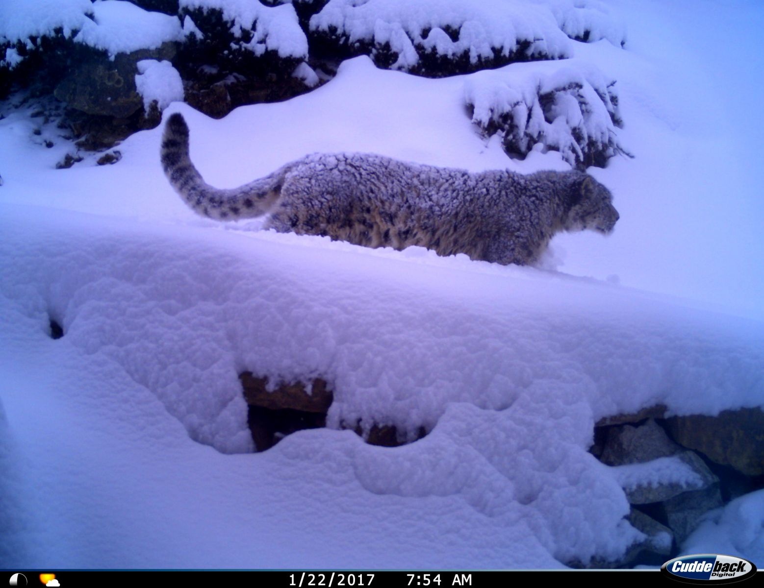
The rugged terrain, deep valleys and complex topography of the Gangotri National Park provide refuge for around 40 mammal species, including the ‘ghost of the mountains’, the snow leopard. Photo Courtesy: WII / NMSHE
Exploring the Unexplored Through the Passes and Mist
Our journeys on foot have acquainted us with places where no other researcher may have ever been. The term Kiyarkoti means “a meadow of flowers”, and every valley had one. Gidara meadow stands out with its picturesque views of vibrant colours in the summers. The greater Himalayan valleys, Kedar valley, Gangotri and Rudragaira have the best of grassy meadows and Betula or Bhoj forests. Further north, in the rain shadow of the Greater Himalaya, lies the Trans- Himalayan region known as the Nelang valley. The valley was inhabited by ‘Jadhs’ (a local community) until the Chinese aggression in 1962. They were then resettled at a lower altitude and the area is now controlled by the Indo-Tibet Border Police (ITBP) and the Indian Army. Some of the pre-war structures related to the old trade route, part of ancient passageways to Tibet, can also be seen here.
Some of the valleys are so narrow and steep that even after two days of trekking, you may be standing in the same grid. Srikant, among all, holds a special place in my heart. Not just because of its immense beauty, but also because of the panoramic view it offers of all the major valleys of the Bhagirathi. It is also one of the longest and most tiring treks. None of the porters agreed to join me for a second time and so each time, I was with a new team. More than the terrain, it is the unpredictable weather in the high ridges, which makes this trek challenging. Time and again, this trek tested my commitment and endurance. In late Octobers, we have struggled with waist-high snow and in the June and July months, we have lost our path because of the mist and fog. I recall one exceptional night in June 2018, when my assistant and I couldn’t return to our camp site, as we were unable to find even a single point to cross the river due to dense fog. We searched for a crossing for at least three hours, until nightfall and were forced to spend the cold night under a rock, to be reunited with our team only the next morning.
As the seasons change, so do the challenges. In altered weather conditions, the same expedition seems different, once snow-covered paths are now exposed, and the wet, grassy slopes even more slippery. The established routes to the camera points offer different obstacles. Some become more treacherous and some a climb to enjoy. The only constants are the miniature cairns, piled up like stacks of coins, guiding us through snow and mist throughout the year.
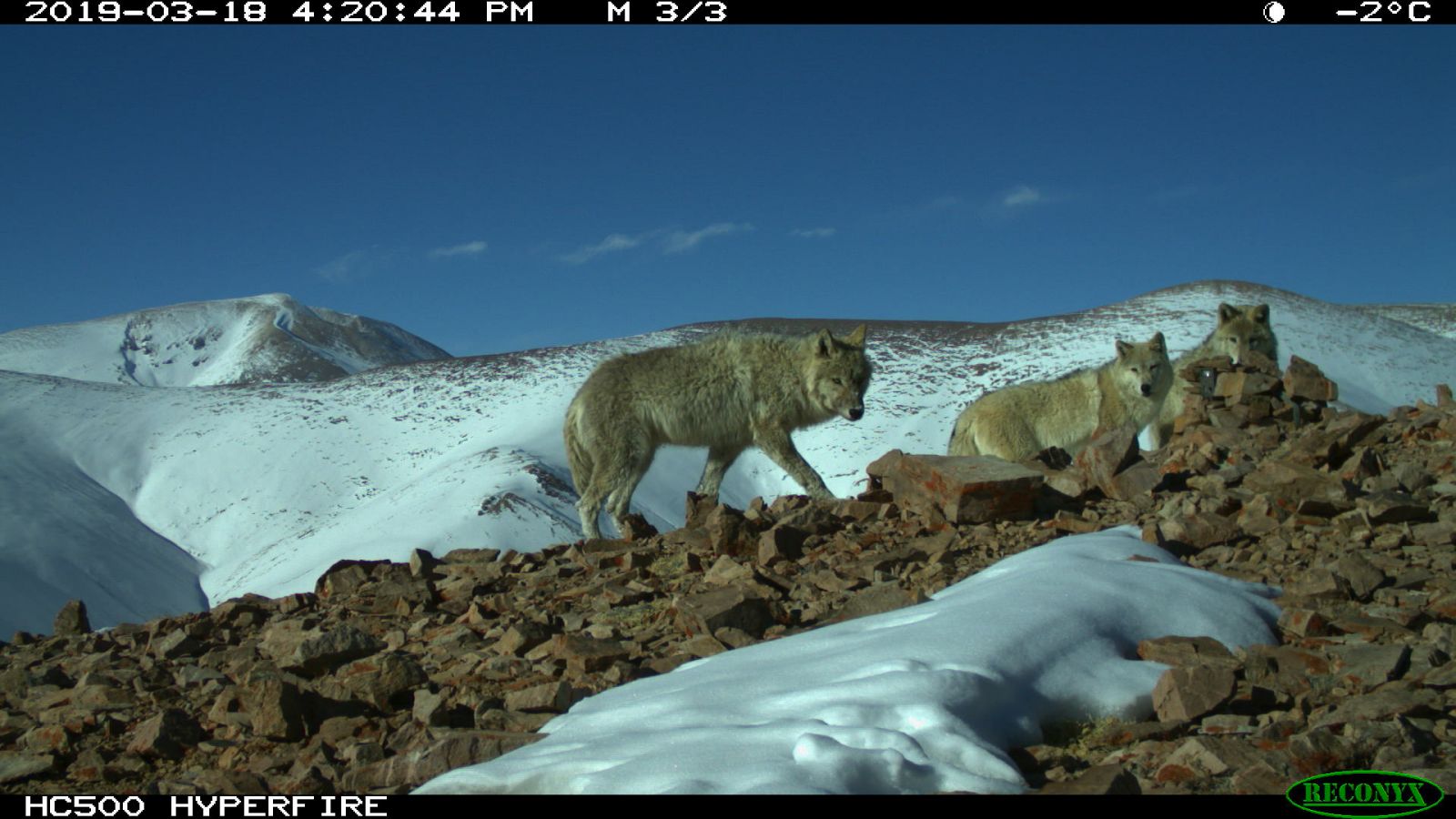
A rare sighting of a trio of Tibetan wolves in the Trans-Himalayan landscape of Nelang valley in the Gangotri National Park. Photo courtesy: WII / NMSHE
The Denizens of Mountains
Only a handful of previous exploratory expeditions in Bhagirathi have recorded the presence of snow leopard, blue sheep, brown bear and musk deer in the high reaches. Leopard, sambar, serow and goral were known to occur in mid and low elevation areas. Our camera trapping efforts enabled a more accurate understanding of animal presence in the region. The presence of the Asiatic wild dog was recorded in the alpine and subalpine region of Kheda tal (famous as a training ground for mountaineers). First records of the presence of trans- Himalayan species like the argali, woolly hare, Eurasian lynx and Pallas’s cat were also recorded in Nelang valley, Gangotri National Park. A tiger’s presence was confirmed in the subalpine forests of Bhilangana valley. And what I consider to be my most important finding is the record of one of the least known mammals of the Himalaya, the endangered woolly-flying squirrel. This was also the highest elevation record of flying squirrel presence, at 4,800 m. near the Srikant glacier. The new distribution records of endangered and rare species depict the suitability of the Upper Bhagirathi basin in terms of cover, food, and connectivity. And, just when I thought the list was complete, while sorting camera trap photos after wrapping up fieldwork, one of the cameras showed a web-footed, whiskered creature moving through the snow. It was an otter. I jumped with joy!
In the field, my stubbornness to get to the remotest places has sometimes caused hardships for my teammates and field staff. But over time, my list of rare species has grown and so has their support. When you are working in such challenging terrain, these discoveries are priceless and encouraging.
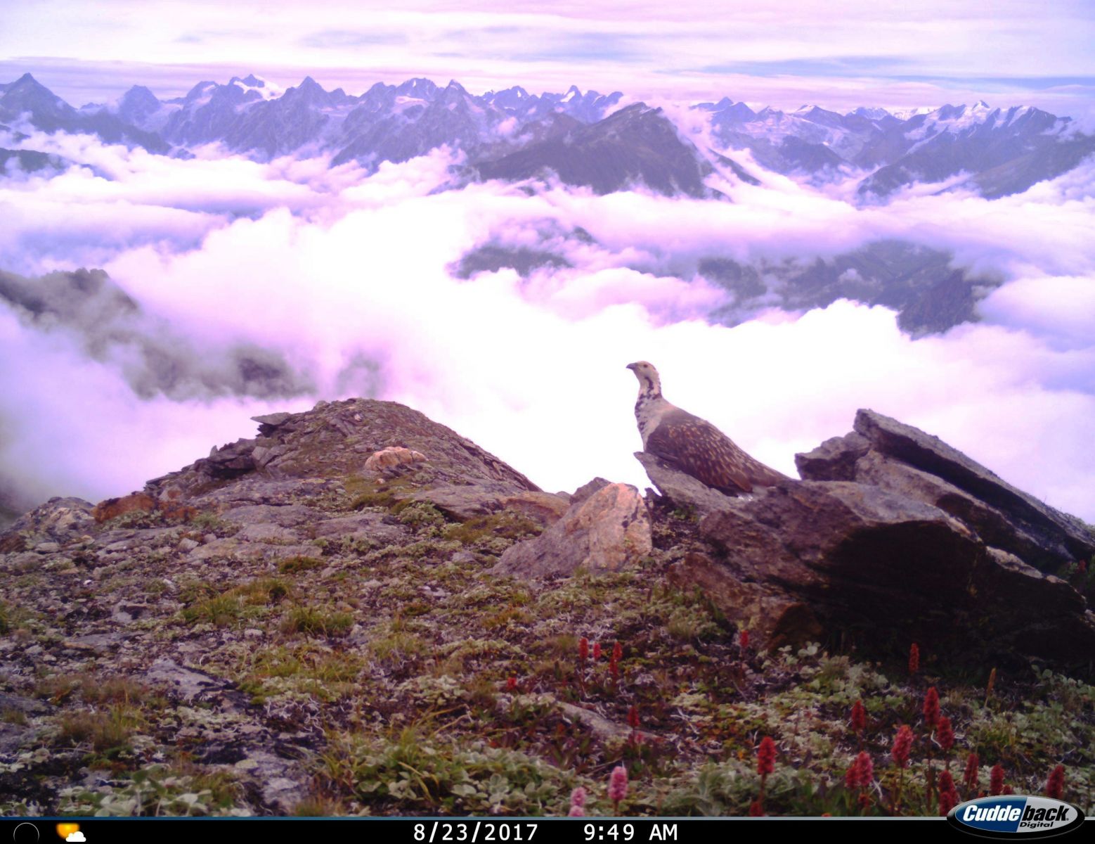
A Snow Cock on a ridge of the Srikant valley, with the Upper Bhagirathi valley in the background. Photo courtesy: WII / NMSHE.
The Himalaya is home to some of the rarest and most iridescent birds. One group which stands out among them is the Galliformes – the heavy-bodied, groundfeeding birds. In lower elevations, early morning calls of the Koklass and Monal helped dissipate our morning drowsiness. In the greater and trans-Himalaya, the screeching Himalayan Snowcock broke the monotony of barren landscapes. In the fourth year of camera-trapping, we also recorded the presence of the Western Tragopan from the mid-elevation areas, designated as Vulnerable according to IUCN. The trans-Himalayan landscape also facilitates suitable areas for the Tibetan Snowcock and Tibetan Sand Grouse.
Changing scenarios in the Bhagirathi
The economy of the Bhagirathi basin is largely dependent on agriculture. The vast and rich alpine meadows attract pastoral communities such as Gujjars and Gaddis. The low elevation subtropical areas are heavily modified with large townships such as Uttarkashi and Tehri. Gangotri is also a prime destination for spiritual and aesthetic upliftment. Tourism, especially mountaineering and pilgrimage, attract millions of people from around the world. Development of roads, electricity, and jobs have reduced the human footprint in the forest areas and have benefitted the wildlife to a small extent. However, threats like poaching and expansion of agricultural practices have grown. The ever-increasing demand for power and electricity has promoted different hydroelectric projects at the cost of forest cover and wildlife. Another threat is the presence of free ranging dogs, even in remote areas. Their invasion of wildlife habitats is a global concern. Our cameras recorded dog attacks on blue sheep, sambar, marmot and red fox. The issue of feral dogs requires immediate management intervention.
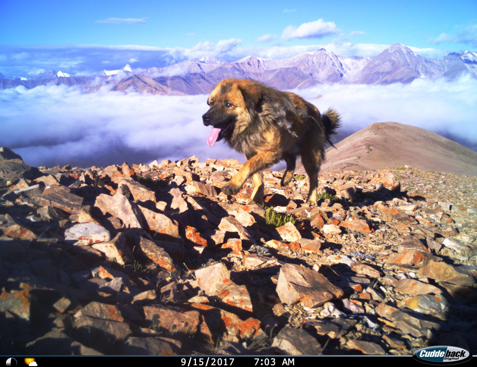
A free-ranging dog at an elevation of 5,000 m. in the Gangotri National Park. During the study, the author’s team recorded dog attacks on blue sheep, sambar, marmot and red fox. The issue of feral dogs requires immediate management intervention. Photo courtesy: WII / NMSHE.
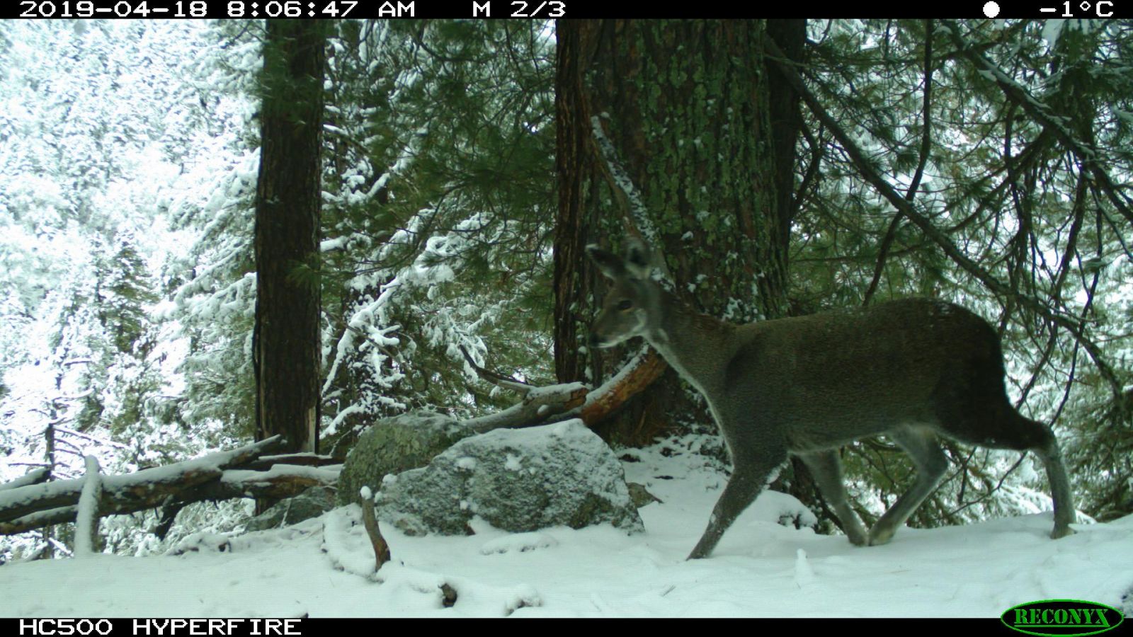
Mountains are likely to experience wide-ranging effects of climate change on the environment, biodiversity and socioeconomic conditions. The Bhagirathi basin has around 238 glaciers, which cover 755 sq. km. The major glaciers such as the Gangotri, the source of the Bhagirathi river and Dokriani glacier are retreating, like other glaciers in the Himalaya. On the way from Bhojabasa to Gaumukh, one can see the marking on rocks of the Gangotri glacier’s previous extent. On my expeditions to Srikant and Gangotri, I have seen signs of development of pro-glacial lakes, another evidence of the impact of global warming in the region. While some animals of the plains like the common leopard, sambar and wild pig might take advantage of receding glaciers and increasing temperatures, animals of the colder climate will struggle to adapt.
Future Refuge
The wrinkled ridges, rugged terrain, deep valleys, complex topography and gradient of habitats facilitate the presence of around 40 mammal species in the landscape. There are still some untouched habitats, owing to the tough terrain and inaccessibility. Such areas showed potential for refuge for some threatened and rare species. Other than the rare records, Bhagirathi was also found to be a potential refuge for six species of threatened mammals, which were captured regularly in the cameras: Himalayan brown bear, Asiatic black bear, snow leopard, common leopard, musk deer and sambar. My survey through remote areas of the landscape shows the potential of the Bhagirathi basin as a stronghold for some of the endangered Himalayan species.
Remote and subalpine habitats are a refuge for endangered species such as the musk deer. Photo courtesy: WII / NMSHE.
I consider myself privileged to have had this opportunity to explore one of the few remaining pristine habitats on earth – the Western Himalaya. In a short span of four years, I was able to appreciate the eternity involved in the making of these intricate relationships among animals and its surroundings. However, I worry that if future naturalists visit this rapidly-changing panorama in an air-conditioned coach, or hover above these mighty peaks, their chances of capturing those eluding shadows behind the rocks, beneath the deodar, or over the rocky ridges may be naught.
Ranjana Pal is an aspiring ecologist and a Ph.D. Scholar at the Wildlife Institute of India. She is currently studying high altitude mammals of the Himalaya, exploring the distribution and dynamics of animal populations to advance conservation planning and implementation.